Building date: 1844
Original use:
Corner structures:
Mortar application and content:
Types and uses of stones:
Types and choice of windows:
Structures with similar masonry details:
Masons who worked on building:
Unique features:
Map views courtesy Google Maps. Address is Google Earth confirmed; 43°50'10.82"N 66°07'15.37"W.
City of Cambridge in the Regional Municipality of Waterloo Maps.
Editor's Note: This wall is not a traditional circa 1820-1865 cobblestone structure.
Trinity Anglican Church Wikipedia article.
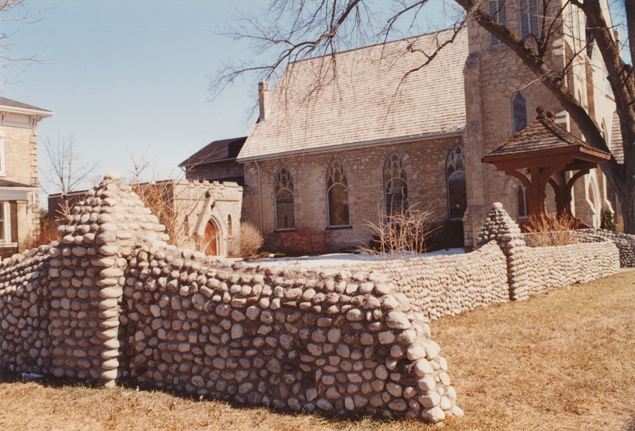 Cam-1 Stone Wall Trinity Anglican Church 1.jpg ¹ | 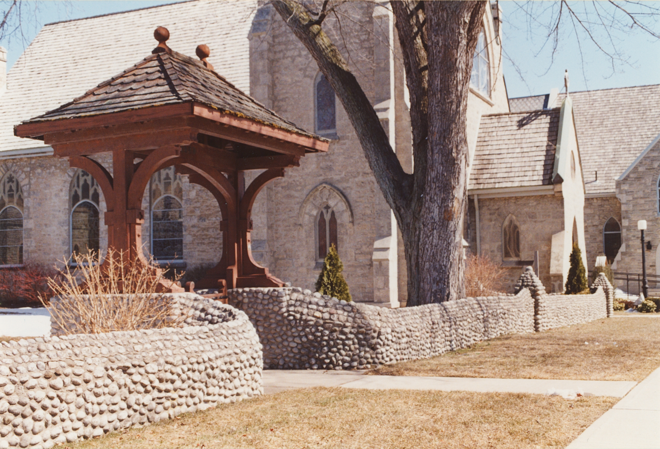 Cam-1 Stone Wall Trinity Anglican Church 2.jpg ¹ |
¹ Photography courtesy Martin and Sheila Wolfish.
